Poseidon Knowledge Hub
Turning ocean data intelligence into health protection.
Explore the reports, blogs, webinars, datasets, and technical resources behind Poseidon's mission to track ocean plastics and protect human health.
This hub brings together the latest thinking, partner coverage, pilot materials, and open data access points that support Poseidon's growing global impact.
Why this hub exists
Research, transparency, and action in one place
Poseidon is real. It is working. And with the right support, it is ready to scale globally. This hub makes the work easier to access, understand, and act on.
From open data access to engineering reports and webinars, the goal is simple: turn insight into action.
Support Poseidon
Help bring Poseidon to life at global scale
You can donate online or contact us for custom collaboration. Your support helps expand public access to Poseidon's data, research, and health protection capabilities.
Latest Insights
Blogs
More from Poseidon & Partners
Featured resources and partner coverage
Explore external coverage, podcasts, reports, and webinars that highlight the Poseidon mission and pilot.
GEO Blog: Mapping the Plastic Crisis from Space
Read how Group on Earth Observations highlighted Poseidon's work in ocean plastic intelligence.
GeoAI Podcast: Raising Awareness & Saving Our Seas
Watch the discussion featuring NOAA, USGS, and NRCan on the Poseidon pilot and ocean plastics.
Pilot Resources: Engineering Report & Webinar
Review the engineering report and webinar materials behind the Poseidon pilot.
Research & Briefing
Whitepapers
Open Data Access
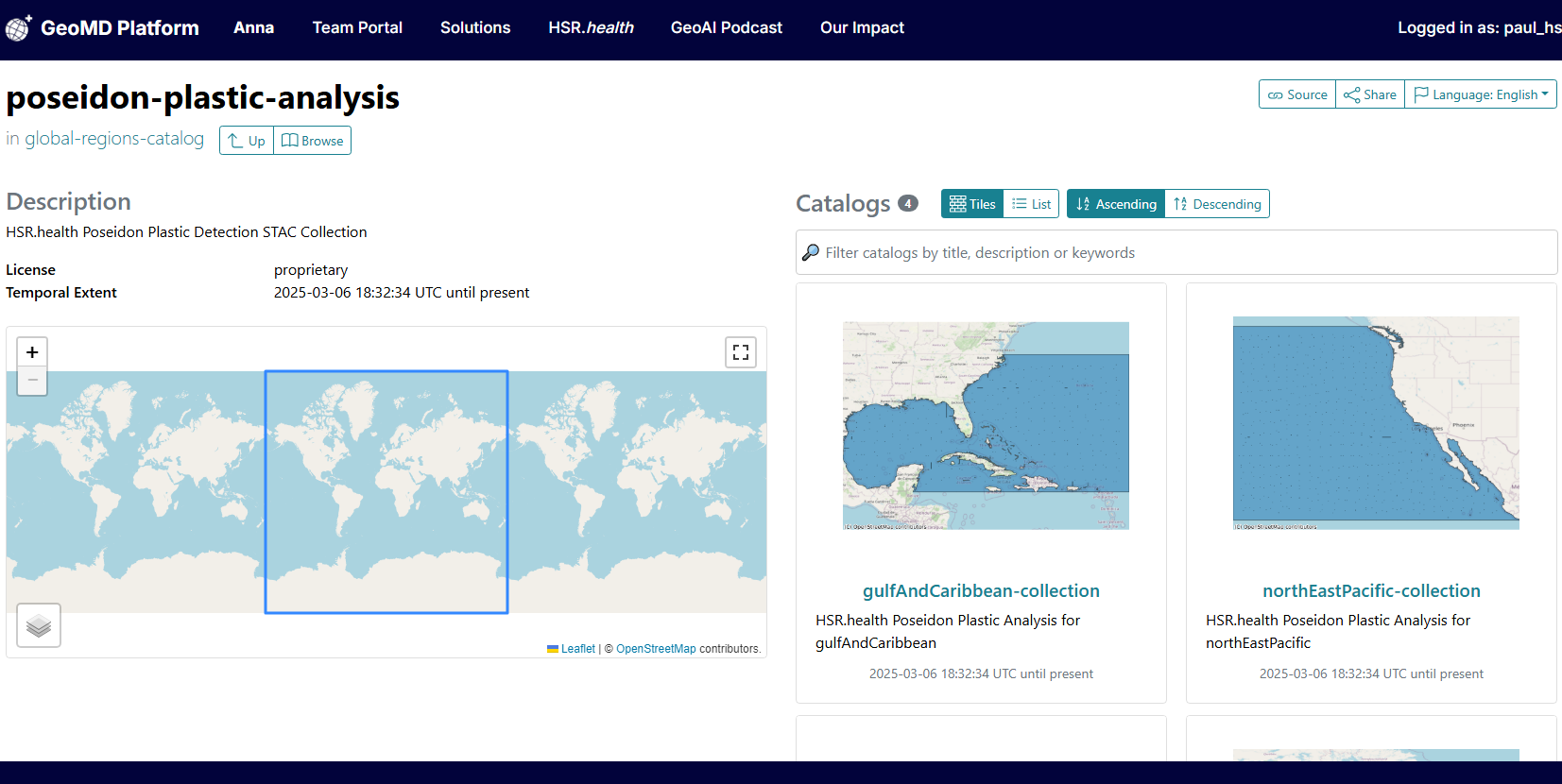
Poseidon STAC Catalog
To increase accessibility and transparency, Poseidon includes a SpatioTemporal Asset Catalog that enables researchers, policymakers, and partners to explore satellite imagery, track plastic presence, and support data-driven interventions.
- Explore Sentinel-2 imagery related to plastic pollution
- Support intervention strategies with real-time geospatial insight
- Enable more efficient global collaboration for ocean plastic tracking
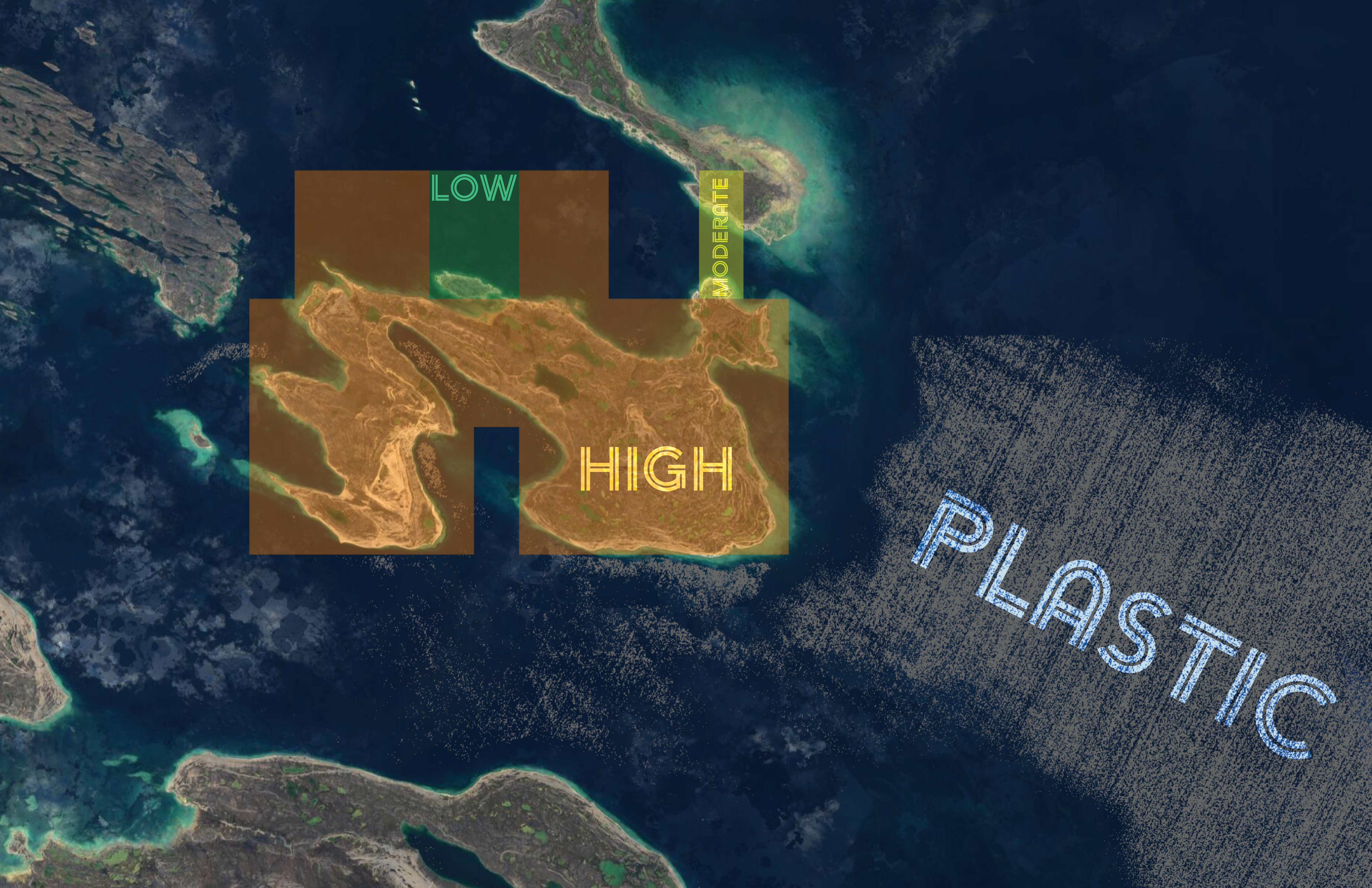
Core System
Poseidon Plastic Tracking System
Toxins are increasing across ecosystems and the food chain in part because of plastic pollution in oceans and waterways. Concern has risen that this plastic may enter fish and other sea life, leading to potentially dangerous exposure through human consumption.
Poseidon was built to identify the presence and quantity of plastics in oceans near populations that may face elevated short- and long-term exposure risk.
Explore Poseidon's Health Impact InsightsDataset Benefits
Why this dataset matters
- Identifies populations at risk for adverse health outcomes from bioaccumulation exposure
- Identifies plastic accumulation in oceans and waterways
- Tracks trends over time to support short- and long-term impact assessment
- Supports policy development for managing microplastic pollution near vulnerable ecosystems and populations
Coverage
Spatial and temporal coverage
Poseidon and its underlying datasets have been calculated for Canada and the North American Arctic. These datasets can be made available for any region or body of water globally.
Temporal coverage spans 2010 to current conditions. Historical trend analysis, continuous updates, and multi-year forecasting can be supported depending on the temporal coverage of the underlying datasets.
Methodology
Process description
Poseidon's Plastic Bioaccumulation Health Risk Index is based on the health and social factors that influence vulnerability to adverse outcomes from plastic bioaccumulation, including age, chronic health conditions, and pregnancy or breastfeeding status. It also leverages Sentinel-2 imagery, map algebra algorithms from Sentinel Hub, and peer-reviewed plastic detection methods to identify plastic presence in oceans and waterways globally.
Availability
Data availability
- Cloud-Optimized GeoTIFF
- CSV
- PNG
- Web Map Service
- Web Feature Service
- OGC API
- GeoJSON
- GeoParquet
- SpatioTemporal Asset Catalog
- Additional user-specified formats
Connect
Work with Poseidon
Reach out to discuss collaboration, support, data access, or the Poseidon case for support.
Impact@geoorchestrationai.com | +1 240-731-0756 | View the Poseidon Case for Support