Story Maps
Geospatial storytelling for real-world health, climate, and resilience challenges.
Explore interactive story maps that reveal meaningful relationships across health, social, economic, environmental, and climate-related factors.
These experiences show how geospatial AI and analytics can turn complex data into clear, visual, and decision-ready insight.
What these pages do
Turn complex geospatial patterns into understandable narratives
From ocean plastics and disaster readiness to care deserts and chronic disease risk, these story maps combine analytics, visualization, and narrative framing to help users see what matters and why it matters.
This is where geospatial intelligence becomes accessible, explainable, and actionable.
Featured Experiences
Explore our story maps
Each story map focuses on a different challenge, using geospatial data and AI-driven insight to surface patterns that are otherwise difficult to see.
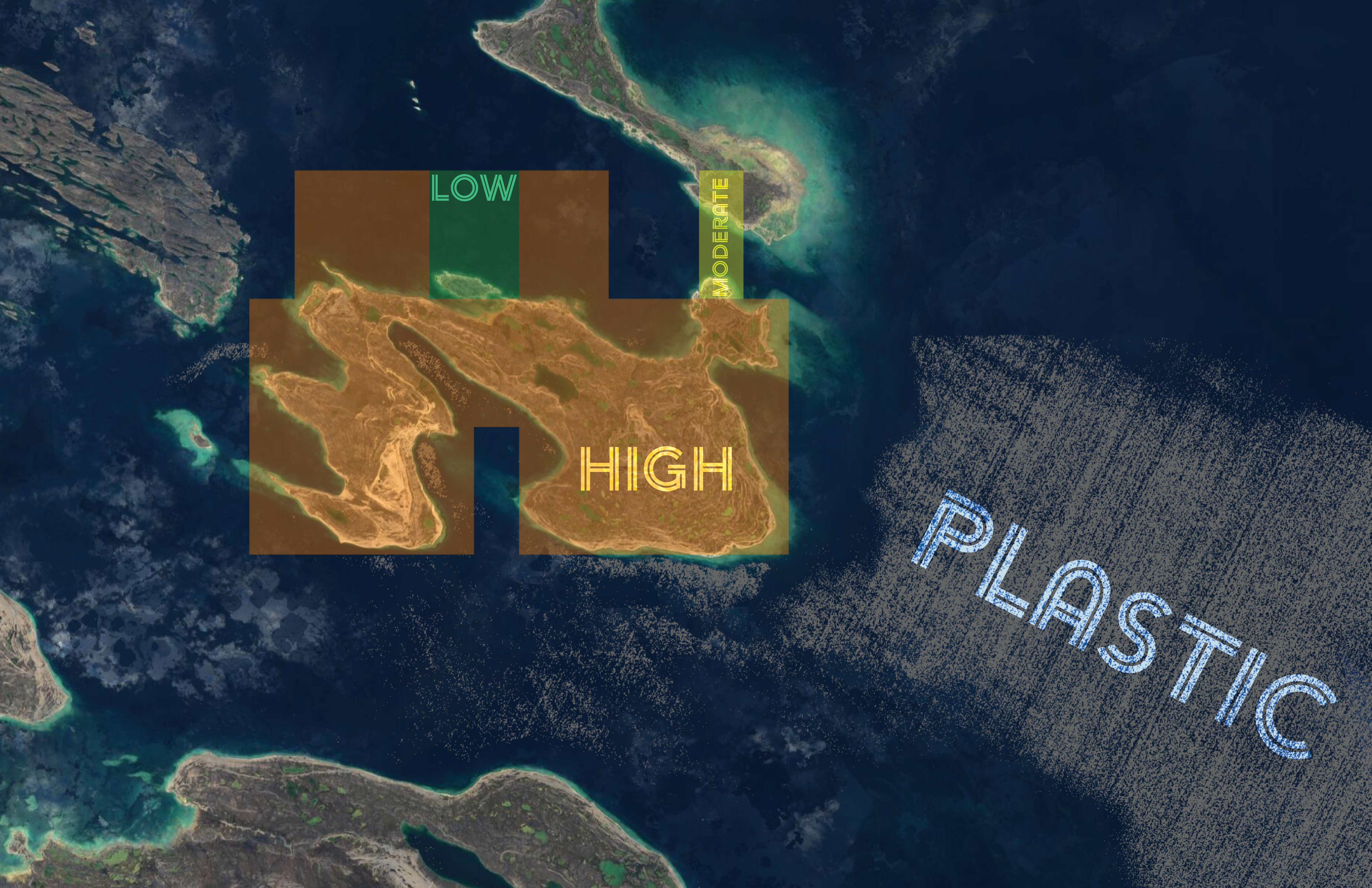
Ocean Plastics
Poseidon Plastic Tracking System
Toxins are increasing across ecosystems and the food chain in part because of plastic pollution in oceans and waterways. Concern has risen that this plastic may enter fish and other sea life, creating harmful exposure pathways for humans.
Poseidon identifies the presence and quantity of plastics in oceans near populations that may face elevated short- and long-term risk.
Explore Poseidon’s health impact insightsDisaster Readiness
Disaster Healthcare Infrastructure Assessment
When a hurricane, wildfire, or earthquake hits, one urgent question stands out: which healthcare facilities are still able to treat patients? This assessment helps answer that in minutes, not days.
Learn more about post-disaster hospital readiness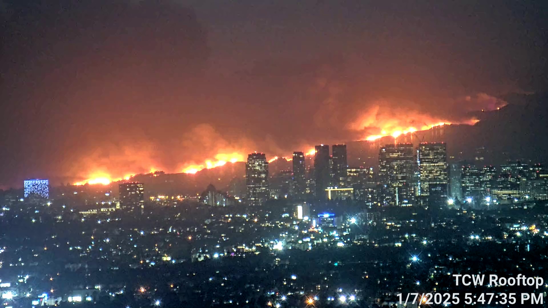
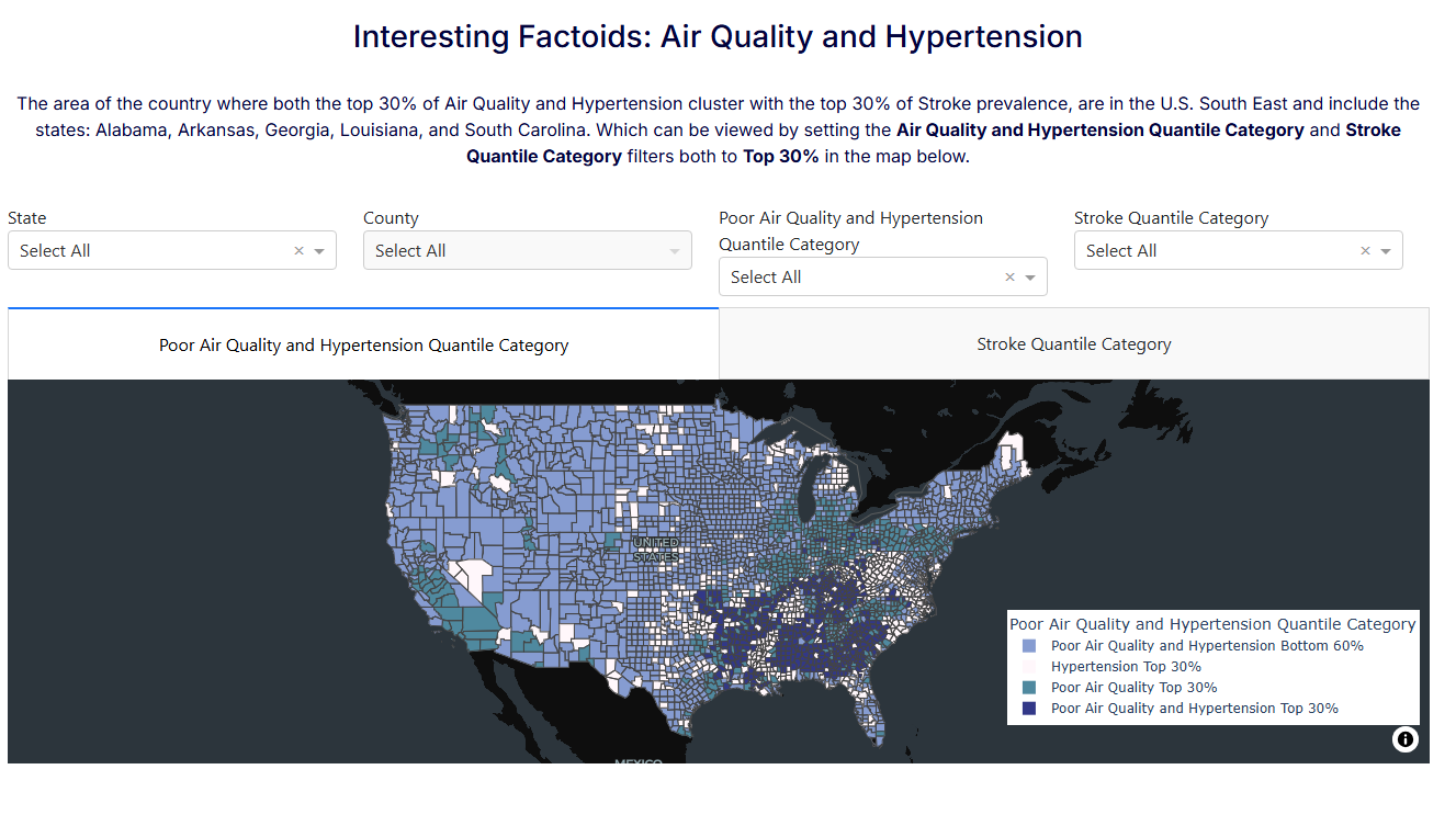
Air Quality & Health
Impacts of Air Quality and Hypertension on Stroke Risk
Research has identified a strong relationship between PM2.5 and stroke incidence and mortality. This story map explores how air quality intersects with known risk factors such as hypertension and obesity.
The result is a more spatially grounded understanding of stroke risk and prevention.
Learn more about air quality, hypertension, and stroke